Ranking the Rhine Crisis: How Low Can Water Levels Go Before Force Majeure Becomes Certain?
Ranking the Rhine Crisis: How Low Can Water Levels Go Before Force Majeure Becomes Certain?
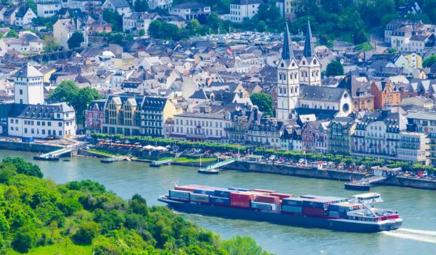
For Europe's industrial economy, there is no more important number than the one on a lonely gauge tower in the Rhine Gorge. The Rhine carries ~80% of Germany's inland waterway freight - grains, coal, iron ore, chemicals from Ludwigshafen, and diesel for Switzerland. When it gets too low, Germany stops.
The number everyone watches is Kaub - at Rhine-kilometer 546.3, just downriver from Pfalzgrafenstein Castle. It's the shallowest part of the Middle Rhine, the bottleneck between the North Sea ports of Rotterdam/Antwerp and the factories of the southwest.
Important: The Kaub gauge reading is NOT the actual depth of the river. It's a relative marker for navigability. A reading of 100 cm does not mean you have 1 meter of water under your barge. But the whole logistics chain is priced off it.
So when does a low river become a legal crisis?
### First, understand Force Majeure on the Rhine
Unlike high water, where there is a hard legal stop - shipping is forbidden above 640 cm at Kaub - there is no state authority that closes the Rhine for low water.
As one Dutch operator famously put it: "The German river police tell us to stop traffic when the water gets too high. But there's no one to tell you what to do when the water gets too low."
Under standard barge transport contracts, force majeure can be declared whenever the safety of crew, cargo, and barges is in danger. That makes it a judgment call for each captain and operator. But history and commercial practice have created a very clear, ranked ladder of pain.
### The 5-Level Ranking of the Rhine Crisis
We can rank the crisis from inconvenient to existential.
#### LEVEL 5: The Watch - Below 150 cm
Status: Low Water Begins
This is where the Rhine officially enters low-water mode. Maersk and other major operators define a low water situation at Kaub as starting from 1.50 meter and lower.
At this level, nothing stops. But barge operators can no longer load fully. Vessels generally need a navigable depth of 1.5 metres at Kaub to sail fully loaded. Deeper-drafted vessels start lightening. Low-water surcharges begin to appear in contracts.
#### LEVEL 4: The Squeeze - 110 cm to 78 cm
Status: Pain is Priced In
This is the surcharge zone.
- Below 110 cm: Operators begin charging low-water surcharges
- Below 81 cm: Surcharges more than double
Once the level at the gauge passes the 78 cm mark, a formal low water threshold is declared.
In practical terms, at 135 cm, a large container ship might have to reduce its load to around 50%. At 77 cm, barging becomes structurally uneconomic for many bulk trades. You are moving a lot of steel to move a little cargo. Deutsche Bank, BASF, ThyssenKrupp - everyone starts running Excel models for rail alternatives.
Force majeure? Not yet. This is still considered a foreseeable commercial hindrance. You pay more, you wait longer.
#### LEVEL 3: The Critical Line - 61 cm to 40 cm
Status: The River Becomes a Business Decision
- Below 61 cm: Surcharges are increased again to compensate for significantly reduced barge volumes
At this stage, the riverbed is visible. The navigable channel shrinks to a narrow trench. Only experienced skippers with empty or one-quarter loaded barges can pass, and only in daylight.
Below 40 cm, it becomes uneconomical for many barges that haul commodities like diesel and coal to sail through that part of the river, according to Germany's Federal Institute for Hydrology.
This is the line where major players walk away. In August 2022, shipping company Contargo, which operates a huge terminal network, said that a drop at Kaub to below 40 centimeters would prompt it to largely discontinue its barge business on the middle and upper Rhine.
Force majeure filings start here, but on a case-by-case basis. Chemical majors and mineral oil companies start invoking low-water clauses.
LEVEL 2: The De Facto Shutdown - 40 cm to 33 cm

Status: Force Majeure Becomes Probable
When Kaub falls below the critical 40cm mark, the river is functionally broken for bulk logistics.
This is what happened on August 12, 2022. The level fell below 40 cm, and it became uneconomical for most barges to carry goods through the waypoint, limiting supplies to parts of Germany and Switzerland.
At 40 cm, the WSA (waterways authority) still has not imposed shipping restrictions, but the industry imposes its own. Neska Container Line announced in 2022 it could no longer call at Cologne and Dusseldorf.
If you are a buyer with a contract referencing delivery ex-Rotterdam via Rhine, this is where your lawyer gets a call. Most courts and arbitrators in 2018 and 2022 accepted force majeure below ~35-40 cm if the operator could prove no viable alternative vessel type was available.
#### LEVEL 1: The Record Low - Below 33 cm
Status: Force Majeure Becomes Certain
This is uncharted territory where safety trumps economics.
The historic lows are etched in industry memory:
* October 22, 2018: 25.28 cm - The lowest since the start of the millennium
* August 2022: 31.48 cm - The low of this decade, with navigable water depth at Kaub down to just 29 cm and forecasts touching 26 cm.
* For reference, the all-time low recorded in 1947 was just 6 cm higher than 48 cm - so around 42 cm.
At these levels, the WSV was forecasting navigable water depth at Kaub would fall from about 35 cm to around 20 cm. That's 20 cm of water under the hull in places. One wrong steering input and you ground.
No captain will risk crew, hull, and cargo for a few tons of coal. Insurance becomes void. At sub-33 cm, force majeure is not an argument - it's a fact of physics. No tribunal will penalize an operator for refusing to sail.
### The Bottom Line
The Rhine never officially "closes" for low water. It dies by a thousand cuts. Here is your cheat sheet:
>150 cm = Normal
150-78 cm = Expensive (Surcharges)
78-40 cm = Critical (Lightening, delays, first force majeure claims)
< 40 cm = Broken (Major operators quit, force majeure probable)
< 33 cm = Closed (Force majeure certain)
For 2024-2026, the danger window has shifted earlier. Where mid-June levels in 2018-2020 were 220-320 cm, we are now seeing June levels at 100-135 cm, triggering red alerts and strict draft restrictions through the Rhine Gorge.
If you have supply chain exposure to the Rhine, don't watch the weather in Frankfurt. Watch Kaub. When it prints 40 cm, call your rail broker. When it prints 30 cm, call your lawyer.
Caustic Soda Pearls - China
Found this useful?